St. George Loop
Overview
 Length: 56 Miles
Climbing: 4,650 Feet
Rating: 5.1
Climbing per Mile: 83
The Country Roads Cyclists bike club is doing this ride from Rowlesburg as part of the Rowlesburg Mountain Roads Touring Festival Labor Day Celebration.
From their website ride schedule: "Sunday, August 31 at 9:00 AM Rowlesburg Mountain Road Tourning Festival, Dave Phillips (304) 594-1036, 56 or 78 miles. A challenging route thru Preston County. Meet at the Rowlesburg City Park to register and receive a map for this free event. From Morgantown, take Rt. 7 to Kingwood, then Rt. 72 South to Rowlesburg. From Clarksburg, take Rt. 50 East to Rt. 72 North to Rowlesburg. Snack Stop and limited SAG will be provided."
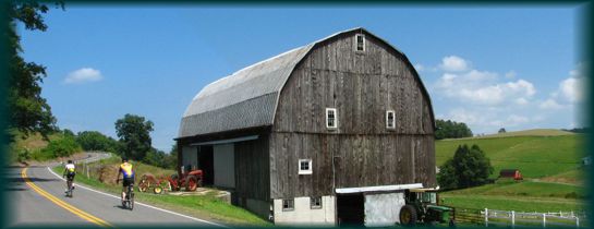
Location: This ride is in northern Tucker and southern Preston Counties and is a beautiful route through farm county and forest. The communities of St. George, Terra Alta, and Rowlesburg are on the route.
For the climbing on this route, you are rewarded with beautiful vistas and a long downhill cruise from Terra Alta to Rowlesburg. This loop is bisected by U.S. route 50, which can be used to create two shorter routes.* A large portion of the route is on two lane stripped roads, but traffic is usually moderate to light. The Country Roads Cyclist bike club has been doing this ride out of Rowlesburg in conjunction with festival activities, on Sunday of Labor Day weekend, and providing their own rest stop in St. George. Because Terra Alta is the only location on the route that has a dependable public food and water source, St. George is the recommended starting point. Starting in St. George, also puts the majority of the climbing in the first half of the ride.
* This route can be divided into two shorter routes using U.S. 50. I would ride the northern route counter clockwise so you are not making a slow steep[ climb on U.S. 50 with its larger traffic volume and blind turns.
PDF Map and Turn List
Ride with GPS file of route created by George Cook
Slides how of St. George, Aurora, Macomber, St. George Portion.
General Route Description
 St. George to Aurora: Starting in St. George, you take Co. 5 (Location Road) and immediately begin seven miles of climbing that is interrupted by 1 1/2 miles of flat or descending road. This long climb is usually 4-7% until nearing the top of climb when you encounter some short steep gradients of 8-10%. Location Road is an un-striped road that has little traffic. It is not long before your climbing is rewarded with some great views of the valley and Limestone Mt. After topping the climb you come to the intersection with Limestone Road. Taking a right here, you soon cross into Preston County and the road becomes Co. 112. The next 7 miles on Co. 112 takes you along the rolling Stemple Ridge, which will still provide you with plenty of shorter climbs. Don't forget to stop and take in the great views of the Cheat River drainage, a good excuse to rest your legs. The last time I did this ride, there was a restaurant at the intersection with Rt. 50 in Aurora, but I would not count on it being open. A relatively flat two mile excursion to the East on Rt. 50 will take you to Cathedral State Park. This is a day use park, but has rest room facilities.
Aurora to Terra Alta: Continuing straight across U.S. 50 onto Co. 53/1 you continue another 9.3 miles of rolling terrain through upland farm country, passing through the small community of Amboy. Co. 53/1 connects with Co. 53 after 1.4 miles. You bare left at the intersection and follow 53 into Terra Alta. Before arriving at Terra Alta, you will pass a large pipeline compressor station. As you begin the gradual descent into the small town of Terra Alta, you can bare left on the first street, take a right at Bridge Street and then a left just before crossing the bridge over the railroad tracks. This puts you on Co. 51, Salt Lick Road. However, you will probably want to continue across the bridge to the convenience store at the junction with Rt. 7 to top off your water bottles and grab a snack. before beginning the descent of Salt Lick.
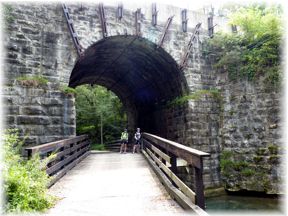
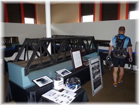
 Terra Alta to Rowlesburg: Leaving Terra Alta on Co. 51, Salt Lick Road, you begin 11.9 miles of "almost" continuous downhill grade into Rowlesburg. The first part of the descent begins with a short steep section, but soon levels out to a long gradual glide down the valley. Nearing Rowlesburg you will encounter a few short climbs as the road skirts the valley. Just outside of Rowlesburg, you will come back in proximity of the railroad. If you keep an eye out to the right, you will see a neat large stone culvert that carries the railroad over Salt Lick, as well as a country road. The road is suspended over the stream by the culvert. Take time to enjoy the craftsmanship that constructed this and has carried coal trains East for over 100 years. The culvert is just at the start of a short climb on Co. 51. Arriving on the outskirts of Rowlesburg, you will cross over the railroad on a fairly new bridge and then cross over the Cheat River into Rowlesburg itself. In "downtown" Rowlesburg you will take a left on State 72 which you will follow back to St. George. In Rowlesburg, you might want to take a break and tour the displays in the old school building if it is open.
 Rowlesburg to St. George: Leaving Rowlesburg on 72 South, you cross the railroad tracks on your way out of town on a slight rise, but for most of the next 2.9 miles it is a flat cruise along the Cheat River to Route 50 at Macomber. At Route 50 you take a right and an immediate left to continue on Route 72 to St. George. Your climbing isn't over for the ride, because there are 3 climbs in the next 14.9 miles. The first and longest begins just after you spot the ATT satellite receiver dishes at Etam. You top out of the climb at the Preston/Tucker County border and then drop back down toward the Cheat River. After two more shorter, but still testing climbs, you are on the home stretch. When you pass the junction of Route 38, you are an eighth of a mile from St. George. Take a left and cross the Cheat River again to get back to the parking area.
Food and water sources.
The incorporated town of Terra Alta provides the most reliable source of food and water along the route, though you need to detour a little to find a store on St. Rt. 7. There is a convenience store in Terra Alta on State Rt. 7, just a short detour off the bike route.
There is a new store, Patriots Four, that opened in 2013 near St. George on the route open Wednesday - Sunday. Being new, I do not know the hours of operation. If you are going to depend on them as a source of food and water, I would contact them first.
The lack of water/food sources on this longer route, is one of the reasons I suggest starting in St. George, so that Terra Alta falls mid way. It also gets the majority of the climbing out of the way in the first part of the ride, but there are still 3 nasty climbs between Macomber and St. George.
Items of Interest Along the Route:
The scenery is the main item of interest along this route. The combination of high mountain vistas and balanced. Cathedral State Park is two miles off the route, if you have the time and legs to take it in. The large satellite dishes of the Etam Earth Station, will surely catch your eye.
Acknowledgements
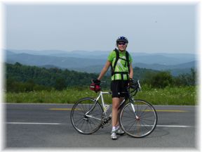
I appreciate Liz and Jay Stevens for accompanying me on one of my circuits of the route and allowing photos of them to be use on this page.
Country Roads Cyclists bike club for introducing the ride and providing a rest stop in St. George when we started in Rowlesburg.
Disclaimer
The listing of routes on this site is not a guarantee of the safety of the route. Cycling has inherent risks and riders skills vary. Traffic conditions vary by time of day, season and local events. Road conditions can vary and change and may change dramatically over one winter season. Riders need to ride within their capabilities and be alert for road hazards and traffic at all times.
Copyright Notice:
This site, maps, photos and all materials created for this site are copyright of the author unless otherwise noted. They may NOT be posted on other sites or reproduced for sale or profit, without specific permission of the author. However, the maps and turn lists may be down loaded for personal, non profit use.
 St. George to Aurora: Starting in St. George, you take Co. 5 (Location Road) and immediately begin seven miles of climbing that is interrupted by 1 1/2 miles of flat or descending road. This long climb is usually 4-7% until nearing the top of climb when you encounter some short steep gradients of 8-10%. Location Road is an un-striped road that has little traffic. It is not long before your climbing is rewarded with some great views of the valley and Limestone Mt. After topping the climb you come to the intersection with Limestone Road. Taking a right here, you soon cross into Preston County and the road becomes Co. 112. The next 7 miles on Co. 112 takes you along the rolling Stemple Ridge, which will still provide you with plenty of shorter climbs. Don't forget to stop and take in the great views of the Cheat River drainage, a good excuse to rest your legs. The last time I did this ride, there was a restaurant at the intersection with Rt. 50 in Aurora, but I would not count on it being open. A relatively flat two mile excursion to the East on Rt. 50 will take you to Cathedral State Park. This is a day use park, but has rest room facilities.
  Terra Alta to Rowlesburg: Leaving Terra Alta on Co. 51, Salt Lick Road, you begin 11.9 miles of "almost" continuous downhill grade into Rowlesburg. The first part of the descent begins with a short steep section, but soon levels out to a long gradual glide down the valley. Nearing Rowlesburg you will encounter a few short climbs as the road skirts the valley. Just outside of Rowlesburg, you will come back in proximity of the railroad. If you keep an eye out to the right, you will see a neat large stone culvert that carries the railroad over Salt Lick, as well as a country road. The road is suspended over the stream by the culvert. Take time to enjoy the craftsmanship that constructed this and has carried coal trains East for over 100 years. The culvert is just at the start of a short climb on Co. 51. Arriving on the outskirts of Rowlesburg, you will cross over the railroad on a fairly new bridge and then cross over the Cheat River into Rowlesburg itself. In "downtown" Rowlesburg you will take a left on State 72 which you will follow back to St. George. In Rowlesburg, you might want to take a break and tour the displays in the old school building if it is open.
 Rowlesburg to St. George: Leaving Rowlesburg on 72 South, you cross the railroad tracks on your way out of town on a slight rise, but for most of the next 2.9 miles it is a flat cruise along the Cheat River to Route 50 at Macomber. At Route 50 you take a right and an immediate left to continue on Route 72 to St. George. Your climbing isn't over for the ride, because there are 3 climbs in the next 14.9 miles. The first and longest begins just after you spot the ATT satellite receiver dishes at Etam. You top out of the climb at the Preston/Tucker County border and then drop back down toward the Cheat River. After two more shorter, but still testing climbs, you are on the home stretch. When you pass the junction of Route 38, you are an eighth of a mile from St. George. Take a left and cross the Cheat River again to get back to the parking area.
 St. George


 St. George
 Looking back toward St. George
 View from Stemple Ridge

 Stemple Ridge
 1
1 2
2 3
3 4
4 5
5 6
6 7
7 8
8 9
9 10
10 11
11 Length: 56 Miles