Spruce Knob Climb - The Top of West Virginia
Overview
 Length: 25.6 Miles
Climbing: 3,050 Feet
Rating: Rating: 2.8*
Total Elevation Change: 2,910 Feet.
Location: This ride is in western Pendleton County, south of Seneca Rocks at Judy Gap.
The US Forest Service has completed the paving of the road to the highest point in the state - Spruce Knob. The paved route is the access from near Riverton south of Seneca Rock on route 33. This allows road bikes to make the climb for the first time.
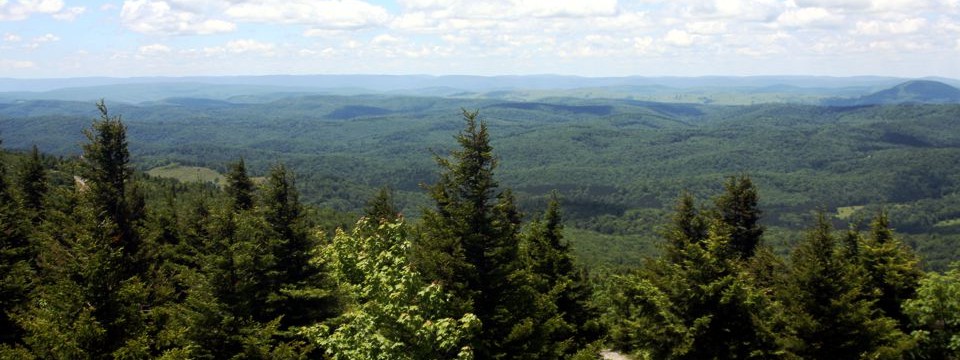
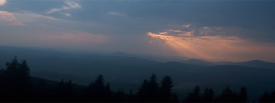
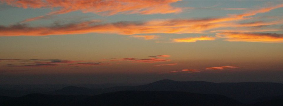
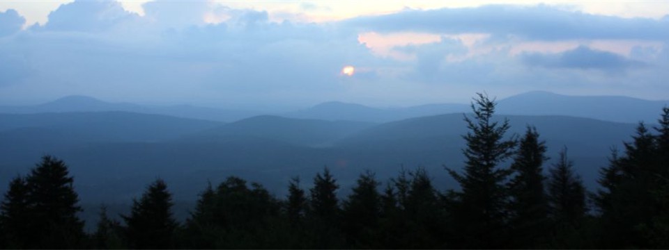
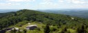
This may be the longest climb in West Virginia, but probably not the hardest. However, there isn't another that rewards you with more spectacular views!
* This is one ride that a higher rating might be appropriate due to the continuous nature of the climbing.
PDF Map and Turn List
Ride with GPS file of route created by George Cook
General Route Description
Almost twelve miles of climbing with an overall average of 4.7% and the first three miles averaging 8%. There is really no respite from the climbing till you are within the last mile of the climb, though the average grade from mile 9 to 10 is less than 2%. After the first four miles, the climb it not bad.
The first 2.6 miles of the climb are on state maintained 33/4 and is two lane stripped pavement. The state has widened the first two miles of this section within past few years, meaning there is little protection from the Sun. It gets the full morning Sun. The mountain would shade it in the late afternoon. The Forest Service maintained section begins where state 13/1 Simoda Road takes off downhill to the left. The road to Spruce Knob turns right uphill and becomes a 1 1/2 lane unstriped pavement the rest of the way. From this point to the intersection of FS 104 that takes you across Spruce Mountain to the Knob itself, the road is mostly shaded.. When you reach FS 104, you have reached the top of Spruce Mountain and have less than two miles to ride across the ridge line to the Knob itself. This final section has the only downgrade of the whole climb just before a final short steep uphill section to reach the parking lot and finish of the climb. FS 104 being on the ridge, provides little protection from the Sun or the frequent winds on top of Spruce Mountain.
Once you reach the top, you get to enjoy 11 miles of uninterrupted descent!
There is public parking available at the intersection of Rt. 33 and Rt 28. one mile south of the beginning of the climb. This gives your legs a some flat riding to warm up before hitting the climb.
0.0 Start: Judy Gap Intersection of routes 28 & 33
1.0 Left on route 33/4. Begin Climb
3.6 Bare right on Forest Service 112
11.0 Right on Forest Service 104
12.8 Parking Lot.
Return the same way.
25.6 Finish
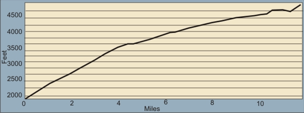 The table below gives the total climb and percent climb by mile. The actual climbing will be slightly more as it does not factor in the slight downhill in the last mile of the climb before the final 8-9% ascent to the parking lot. These are "average" percent, so there will be shorter sections of more or less percent climbing
|
Mile
|
Total Elevation Gain
|
Average Percent Grade to Mile
|
Elevation Gain From Last Mile
|
Percent Grade for Mile
|
| 1 |
440 |
8.3% |
440 |
8.3% |
| 2 |
834
|
7.9%
|
394
|
7.5%
|
| 3 |
1260
|
8.0%
|
427
|
8.1%
|
| 4 |
1600
|
7.6% |
339
|
6.4%
|
| 5 |
1788
|
6.8%
|
188
|
3.6%
|
| 6 |
2007
|
6.3%
|
219
|
4.1%
|
| 7 |
2170
|
5.9%
|
163
|
3.1%
|
| 8 |
2358
|
5.6%
|
188
|
3.6%
|
| 9 |
2483
|
5.6%
|
125
|
2.4%
|
| 10 |
2582
|
4.9%
|
99
|
1.9%
|
| 11 |
2744
|
4.7%
|
162
|
3.1%
|
| 11.8 |
2900
|
4.7%
|
156
|
3.0%
|
Local Sources
 There are convenience stores at Riverton and Seneca Rocks. Public rest rooms at the National Forest Seneca Rocks Visitors Center. Nearest bike shops are in Elkins.
Lodging and Camping:
There are multiple lodging opportunities in the area. Listing of Pendleston County Lodging.
Nearest campgournds are the Monongahela National Forest's Spruce Knob Lake and Seneca Shadows Campgrounds. Seneca Shadows Campground is located near Seneca Rocks, has hot showers and flush toilets and an excellent view of Seneca Rocks.
My favorite place to camp and one of my favorite in the state, is the Spruce Knob Lake Campground. This is located eight miles from the Knob, above Spruce Knob Lake. The campgound is primitive with pit toilets and no electric sites. Provides easy access to the lake and the Sinks of Gandy. I really enjoy this area - in the warmer months.
Food:
Listing of restuarants can be found on the Pendleton County Tourism site. If I am in the area and have time, I always stop at the Front Porch Restaurant and have one of there fabulous hot apple dumplings. You can sit on the porch and eat it while watching the climbers on Seneca Rocks.
Disclaimer
The listing of routes on this site is not a guarantee of the safety of the route. Cycling has inherent risks and riders skills vary. Traffic conditions vary by time of day, season and local events. Road conditions can vary and change and may change dramatically over one winter season. Riders need to ride within their capabilities and be alert for road hazards and traffic at all times.
Copyright Notice:
This site, maps, photos and all materials created for this site are copyright of the author unless otherwise noted. They may NOT be posted on other sites or reproduced for sale or profit, without specific permission of the author. However, the maps and turn lists may be down loaded for personal, non profit use.


 1
1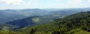 2
2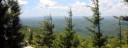 3
3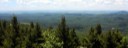 4
4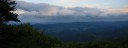 5
5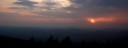 6
6 7
7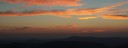 8
8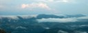 9
9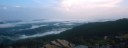 10
10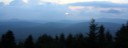 11
11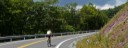 12
12