General Description
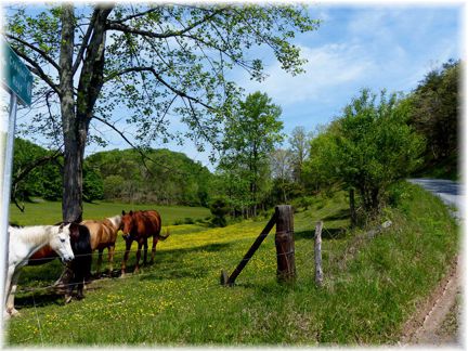
Like most of the rides in Monroe County, the route doesn't touch on any real populated communities. Place names on the route serve more as location references then population centers. This ride combines some great vistas from the ridges of Kibble Hill to beautiful farms along Hans Creek.
Start: A convenient place to start is the church in Red Sulphur Springs on Co. 23 - Indian Creek Rd. The Map and turn list has mileage starting at the intersections of state route 3, Co. 23 and Co. 27. I like to ride this counter clockwise and get the major climbing out of the way. Once you leave the ridge, you are going downstream the rest of the ride.
Riding in a counter clockwise direction and leaving from Red Sulphur, you begin an immediate steep climb up Kibble Hill on Co. 27. The climb is 1.2 miles and about .5 of it exceeds 10%. For all that effort, you are rewarded with a great vista at the top and for the next few miles as you head south along the ridge on Co. 27. You roll along the ridge past Orchard on a single lane pavement until the intersection with Co. 27/2 when Co. 27 becomes two lane. Only 0.5 miles further and you make a left onto 25/2 and begin a steep descent on single lane pavement to the valley formed by Blue Lick Creek.
Heading down Blue Lick Creek takes you to Hans Creek where the paved route becomes Co. 25 (Co. 25 goes off to the right as a gravel road.) The valley gets wider as you descend and there are some large and old farms and dairies along the route. There are a couple open medal deck bridges on the road, so be on alert for these. Some of the farms have been in the same families for seven generations. About half way down, Co. 25/2 comes in from the left. You can take a left her and climb Kibble Hill again to short cut the route, but it is another hard climb. Continuing down 25 you cross the second open deck bridge over Indian Creek just before you reach state route 122.
Taking a left on the two lane route 122 you have a couple rollers in the next 1.8 miles before taking a left on Co. 23. There are places on Co. 23 where the pavement is less than desirable, but it is passable and there is little traffic to worry about and the pavement gets better the closer to Red Sulphur you get.
This slides how follows the route in a counter clockwise direction
Ride Options
The dotted lines on the map provide some convenient options to extend or in the case of 25/2, shorten the route.
Taking 25/2 down Kibble Hill divides the route about in two. The northern shorter loop is 12.4 miles, and the southern loop is 14.5 with two hard climbs.
If you want to add some climbing to the route, try taking co. 19, 17 and 17/2 off of state route 122. This takes you up near Marie in Summers County and adds about 700 feet of climbing in an additional 4.5 miles (155 feet per mile). I did not indicate this as an optional route, but if you can tolerate really bad pavement, continuing down 21/1 to state 12 is an option. When you come out on Rt. 12, you have one of the best vistas in the county and a great descent on Rt. 12 down to Red Sulphur Springs.
On the southern section of the route, you can take Co. 33 out toward Ballard and then 27/2 back to Co. 7. This adds 4.2 miles to the route. While Co. 33 it fairly flat, 27.2 add a couple climbs to the route.
 Length: 21.7 Miles
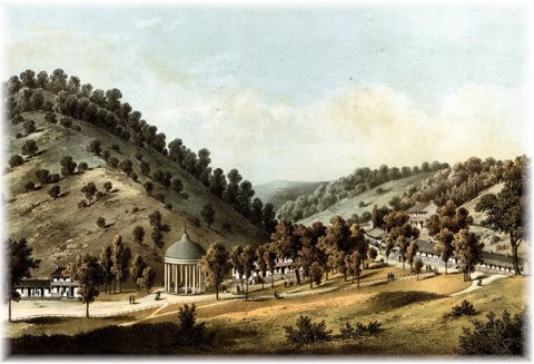
 Red Sulphur Springs was a popular resort in the 1800's, perhaps only second to White Sulphur Springs. Basically nothing remains of the resort today except the rock enclosure around the spring. The resort was once owned by Levi Morton, vice president during the Benjamin Harrison administration. Francis Scott Keye was one of the famous visitors to the resort. It could accommodate 350 people in its prime. Chapter X1 of