


 1
1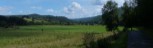 2
2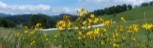 3
3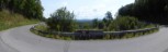 4
4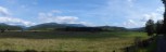 5
5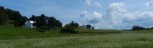 6
6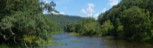 7
7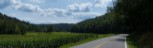 8
8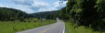 9
9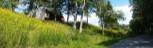 10
10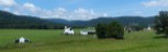 11
11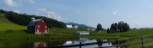 12
12General Route Description
From Marlinton to Cass, you are following along the foothills of the mountains, which gives you a rolling terrain with lots of climbing. From Cass to Marlinton, you are traveling valleys with relatively flat terrain except for the portion around Dilley's Mill.
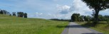
From Huntersville to Marlinton: The intersection of state routes 28 and 39 near Huntersville is one of my preferred starting locations. There is a large parking area at the location. This section generally has the most traffic and by starting here, you get it out of the way while you are fresh and also warms your legs up before tackling the climbing on the next section. This section is fairly flat and overall down hill as the road follows Knapp Creek to Marlinton. You have a small climb as you near Marlinton and then drop into Marlinton and proceed thru town to the stoplight. I often take a the first left at the bottom of the hill and detour past the county courthouse and thru the residential section of Marlinton before rejoining the route.
Marlinton to Edray: Arriving at the stoplight at the junction of 39 and 219, you take a left and go a short distance and take the next right onto Jericho Road. You begin a gradual ascent that continues to get steeper as you pass an old rock quarry. The next three miles is rolling terrain with some short steep climbs before descending down past the old log church. From there you bare left at the intersection with Stoney Creek Road and gradually climb up to Woodrow Road with views of some beautiful farms. Taking a right at Woodrow Road, you drop down past the state fish hatchery and then begin a steep climb up to the intersection with U.S. Route 219. There is a convenience store at this intersection and the last chance to top off the water bottles till Cass. Approaching the intersection, you pass by one of the most photographed barns and farm in West Virginia.
Optional Routing: Arriving at the junction of routes 39 and 219, you take a right, follow 219 till you cross a bridge and take an immediate left onto Co. 219/3 Stoney Creek Road at Cambelltown. You follow the road till it intersects with Jericho Road and the main route. This option is 0.4 miles shorter and cuts out 276 feet of climbing.
Edray to Clover Lick: Taking a left onto route 219, you pass a couple churches before baring right on County 1, the Edray Road. From here you begin a series of descents followed by climbs, gradually gaining altitude reaching the high point on Edray road shortly before descending thru The Loop. Climbing is not over on this section, but overall you will be descending till you reach Clover Lick. You have a final long descent thru trees before breaking out into the valley where the Greenbrier River once flowed, and you follow along the edge of the valley before arriving at Clover Lick.
Optional Routing: You can take a left on Beverage Road and skirt the upper and far end of the valley before arriving at Clover Lick. This became available in 2024 with paving of Beverage Road. This option is 0.3 miles shorter and adds 187 feet of climbing.
Clover Lick to Cass: This section has a good climb out of Clover Lick valley and then you drop down to Stony Bottom before climbing again to state route 66, 1.2 miles before arriving at Cass. This is a tough section of the route with over 1,000 feet of climbing, but the climbing per mile really decreases after Cass until you get to Dilley’s Mill. Food and water sources at Cass.
Cass to Dunmore: Leaving Cass on state route 66, you then pick up state route 92 and head north thru Greenbank. There is a convenience store in Greenbank. Rolling thru Greenbank, you take a right onto Wesley Chapel Road (28/5) at the post office and you are back on farm roads again. The Greenbank Observatory is nearby and makes a nice detour if you have the additional miles in your legs. This is real pleasant cycling thru farming country, but also open with little shade. Only a few minor climbs till you get to Dunmore.
Dunmore to Huntersville: In Dunmore, you turn onto state route 28 in Dunmore, which you follow for “most” of the way back to Huntersville. From Dunmore to Seneca State Forest you are on a gentle upgrade.
Water can be found behind the forest office from the faucet on the side of the shower building behind the office. This is the last source for water before Huntersville.
Leaving the office you go down Route 28 a short distances and turn left on the Co. 13 just past the football fields and begin climbing up to the ridge that separates routes 28 and 92. Reaching the top of the ridge, you turn right onto route 13/1 Gordon Dilley Road. This route follow the ridge for about 4 miles with some descents and climbs and some great vistas before descending back to route 28. From the intersection you continue to descend most of the way back to Huntersville, with only a couple rises to interrupt a pleasant cruise to Huntersville.
Optional Routing: You may continue on state route 28, all the way back to Huntersville. This is 4.4 miles shorter and cuts out 581 feet of climbing.
Food-Water Sources:
For the 62 mile long loop, after leaving Edray, you can find food and water in Cass, and Greenbank, and water at Seneca State. Forest.,