


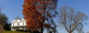
 Looking SW toward Peters Mountain
 1
1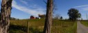 2
2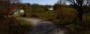 3
3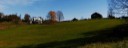 4
4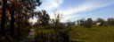 5
5 6
6 7
7General Route Description
This route loops around the karst plateau in central Monroe County. With an altitude variance of only 308 feet, there are no significant climbs on the route. The worst climb is the steep 1/10 of a mile on Route 11 to the Hillsdale-Tollgate Road that starts from a stop sign.
Through there are no major climbs, the route is far from flat, as the karst terrain is constantly rolling.
Traffic is light to moderate with the exception of 1.1 miles on U.S. 219, which it the major traffic route thru the county.
There are no stores along the route, but there is a store in Pickaway at the intersection of U.S. 219 and Rt. 3.
From start to Rt. 219. Leaving from the Vernon Church, you have 0.3 miles before making a left on Charles Boothe Rd. (219/4), a narrow country road, and immediately begin the rolling terrain that is featured on the route. After 0.8 miles, you take a right on Givens Rd. (11/1) and continue riding thru beautiful farm county. At the end of Givens Rd. you intersect the Hillsdale Rd. (11) and you make a right and begin a very steep climb from a standing start. After only 0.1 miles you reach the top and take a right on Tollgate (219/5). This section has some nice vistas before dropping down to the intersection with 219.
219 to Sinks Grove: After making the right onto Rt. 219, you have 0.8 miles on this major route where you can expect some traffic, before taking a left on Stringtown Rd. (3/6). Stringtown is a pleasant rolling ride with some pretty farms. Taking a left at the end of Stringtown Rd. onto State Rt. 3, you have one mile to the intersection with Cty. 5 in Sinks Grove. Rt. 3 is two lane road and you can expect moderate, but not heavy traffic.
Sinks Grove to Monitor: After taking the right onto Cty. 5 in Sinks Grove, you make another quick right just past the Bob and Bob store in "downtown" Sinks Grove onto the Nickols Mill Rd. (5/3). After 1.6 miles, you take a right onto Neff Orchard Rd. (5/1). This is a real pleasant section of the ride as you have some nice vistas, without a lot of climbing. You will pass around the Morgan Orchards, which is a good place to pick your fruit in season. Though the map indicates you are switching to different routes on this section, you are following the only paved road, until the intersection with Moore Rd (219/2) where you bare right for the last 0.4 miles to the finish.
Click on the route number in the window below and download GPX file from the right hand column of Bikemap.net route.
Food-Water Sources:
There are no stores along the route, but there is a convenience store in the middle of the loop in Pickaway at the intersection of Rt. 3 and Rt. 219.