General Route Description
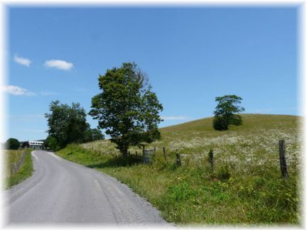
 This ride travels though some beautiful farm country, North and South of the Greenbrier River, as well as climbing in and out of the Greenbrier Valley twice. The route follows two lane striped highways from Lewisburg to Alderson, but traffic is usually light. From Alderson till the junction with US 60, the route follows narrow county roads.
Lewisburg to Sinks Grove: Leaving Lewisburg on Church Street, you immediately ride into some beautiful rolling farm county following routes 60/13 and 37. Arriving at the junction of Rt. 63, you take a right and begin a steep descent down to the Greenbrier River. At the bottom of the descent, you take a left on Co. 43. Continuing on St. 63 takes you to Alderson and cuts 14 miles off the route. St. 63 between Fort Spring and Alderson can have some high speed traffic on it.
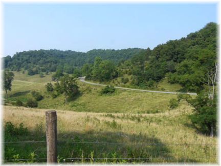
Continuing on Co. 43 you cross the river on an medal open deck bridge (caution) and bare left. Arriving at Fort Spring. you make a sharp right and begin the mile plus climb out of the Greenbrier Valley. On the climb, you will have views of the railroad tunnels and the valley formed by the Fort Spring oxbow. Topping the climb, you have a view of beautiful rolling farmland formed by the karst topography of the area. The next few miles are rolling and overall upgrade until the short steep descent to Sinks Grove.
Sinks Grove to Alderson: Taking a right in Sinks Grove onto state route 3, you have a couple stair step rises before before the long twisting descent into the valley formed by Wolf Creek. This is a fun descent, but has some sharp turns. Arriving a the bottom, you have a fun flat section of road, as it skirts the edge of the valley. Turning away from he valley you have a couple of accents before a short twisting descent into Alderson. When arriving in Alderson, go straight across the pedestrian bridge where route 3 make the 90 degree left past the railroad station and take a right onto state Rt. 12.
Alderson to Blue Sulphur: Leaving Alderson on Rt. 12, you will continue on Rt. 12 at the intersection with Rt. 63, and begin a slight short climb thru the community of Palestine. AT the top of the climb you bare left onto Co. 25 and after a short descent down to Muddy Creek you have a steep ascent. While the road to Blue Sulphur follows the Muddy Creek drainage, it takes a direct route resulting in 3 good climbs between Alderson and Blue Sulphur. Arriving at the junction of Co. 31/2, you take a right to begin swinging back toward to Lewisburg. You will want to continue straight her for a one mile detour to the sight of the former Blue Sulphur Springs resort. The only remains of the resort is the old pavilion over the Spring itself. After viewing the site, you will return back to the31/2 junket and take it. Where 31/2 meets Co. 31(Springs Valley Road) you take a hard right. At this location is the farm where General Lee's horse Traveler was raised.
Blue Sulphur to Asbury: Leaving the Blue Sleeper area on Co. 31 you will have a couple short climbs, before a hard climb up to Rt 12 at Ashbury. You cross Rt. 12 at an angle onto Co. 33.
Asbury to: Lewisburg: Traveling thru Asbury, you have a slight downgrade before beginning the ascent of Muddy Creek Mountain. Fortunately, the long climb is shaded until reaching the top. Topping out the climb, you have a rolling ride across the top before beginning the descent after passing the junction of Co. 40 that comes in from the right. This is a long descent and the road surface and may have defects that are hard to see in the shade, so be careful on the descent. . Partway down the descent you come out of the woods and have a wonderful view of the valley. After the descent you quickly begin another steep climb before a short flatter section out to the junction with US 60. You follow US 60 and then take a right onto McElhenny Road, which lead you back to Lewisburg. As you begin the final descent to Lewisburg, you will pass the the entrance to the civil war cemetery on the left.
Food-Water Sources:
After leaving Lewisburg, the only public and water sources are in Alderson. You don't want to leave Alderson without full water bottles as there are lots of climbing left in the ride.


 Alderson


 Length: 47.7