


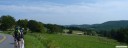
 View from Stemple Ridge


 1
1 2
2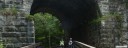 3
3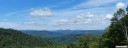 4
4 5
5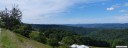 6
6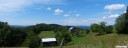 7
7 8
8 9
9Preston County Rides
We hope you enjoy your cycling experience in this beautiful area of the state. The rides are listed in ascending rating of difficulty.
- Macomber Loop, 40.3 Miles, Rating 3.8
- St. George Loop, 56 Miles, Rating: 5.1
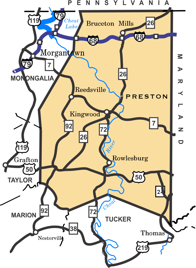
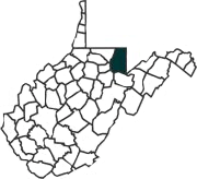 Preston County is located in the northern part of the West Virginia, bordering Pennsylvania and Maryland. Predominant features of the county are high upland farms and and the scenic Cheat River, which runs South to North and divides the county in half. Preston County is known for its severe winter weather conditions.
We hope you enjoy your cycling experience in this beautiful area of the state. The rides are listed in ascending rating of difficulty.
Preston County was established in 1818, from land taken from Monongalia County. Mining and agriculture have been major industries in the county, however,mining has declined in recent years. A federal prison has been built in the northern part of the county. Transportation has played a major part in the history of the county. The National Road, (US 40) passes just above the northern border of county, connecting the East Coast with the Ohio River. The Northwestern Turnpike (US 50) which passes through southern Preston. was built in the 1830's, connecting Winchester, Virginia with the Ohio, River. This route was a major thoroughfare through northern WV from the time it was built, until the mid 1970's, when Interstate 68 was completed across the northern part of the county. One of the route options takes you off of Cheat Mountain on the Northwestern Turnpike.
The major transportation feature in Preston County however, was the construction of the Baltimore and Ohio Railroad (now CSX). in the 1850's. The terrain in Preston County was the biggest obstacle to completion of the railroad to the Ohio River. Three steep grades, and what was then the longest tunnel in the world, were required to get the railroad through Preston County. Another major engineering accomplishment, was the construction of the Tray Run Viaduct, just West of Rowlesburg. This was considered significant enough engineering achievement, that is was featured on the back of the WV state seal, which is now the Governor's seal. This structure was later replaced by a massive stone arch viaduct that still carries coal trains after 100+ year of service. One of the bike routes parallels the line from Terra Alta to Rowlesburg. If you were to ride this from Rowlesburg to Terra Alta, you would get an appreciation of what it takes to lift a train of 100+ 120 ton coal cars up the grade. The section of railroad between Keyser and Grafton is considered one of the toughest areas to operate trains in the United States.
Nearest Bike Shop: Blackwater Bikes, Davis, Tucker County
The listing of routes on this site is not a guarantee of the safety of the route. Cycling has inherent risks and riders skills vary. Traffic conditions vary by time of day, season and local events. Road conditions can vary and change and may change dramatically over one winter season. Riders need to ride within their capabilities and be alert for road hazards and traffic at all times.
This site, maps, photos and all materials created for this site are copyright of the author unless otherwise noted. They may NOT be posted on other sites or reproduced for sale or profit, without specific permission of the author. However, the maps and turn lists may be down loaded for personal, non profit use.